蘇梅 (烏克蘭):修订间差异
外观
删除的内容 添加的内容
补救6个来源,并将0个来源标记为失效。) #IABot (v2.0.8 |
无编辑摘要 |
||
| 第1行: | 第1行: | ||
{{Unreferenced|time=2015-09-16T04:08:09+00:00}} |
{{Unreferenced|time=2015-09-16T04:08:09+00:00}} |
||
{{Otheruses|subject=乌克兰城市}} |
{{Otheruses|subject=乌克兰城市}} |
||
{{Infobox settlement |
|||
| name = 蘇梅 |
|||
| native_name = {{lang|uk|Суми}} |
|||
| total_type = <!-- to set a non-standard label for total area and population rows --> |
|||
| motto = <!-- images and maps -----------> |
|||
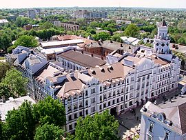
| image_skyline = {{Photomontage|position=center |
|||
| photo1a = UkrainianAcademyOfBanking.JPG |
|||
| photo2a = Дзвіниця Спасо-Преображенського собору в Сумах.jpg |
|||
| photo2b = Сумський обласний художній музей ім. Никанора Онацького .jpg |
|||
| photo3a = Пам'ятник Тарасу.jpg |
|||
| photo3b = Сумська Альтанка зима ніч.jpg |
|||
| photo4a = Sumy Nezalezhnosti 19 Voskresens'ka Tserkva 05 (YDS 7866).JPG |
|||
| size = 270 |
|||
| spacing = 2 |
|||
| color = #FFFFFF |
|||
| border = 0 |
|||
}} |
|||
| imagesize = |
|||
| image_caption = |
|||
| image_flag = Flag of Sumy.gif |
|||
| flag_size = |
|||
| image_seal = |
|||
| seal_size = |
|||
| image_shield = Sumy-COA.PNG |
|||
| shield_size = |
|||
| image_blank_emblem = |
|||
| blank_emblem_type = |
|||
| blank_emblem_size = |
|||
| image_map = |
|||
| mapsize = |
|||
| map_caption = |
|||
| image_map1 = |
|||
| mapsize1 = |
|||
| map_caption1 = |
|||
| image_dot_map = |
|||
| dot_mapsize = |
|||
| dot_map_caption = |
|||
| dot_x = |
|||
| dot_y = |
|||
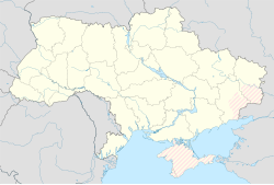
| pushpin_map = Ukraine |
|||
| pushpin_label = 蘇梅 |
|||
| pushpin_label_position = left<!-- the position of the pushpin label: left, right, top, bottom, none --> |
|||
| pushpin_map_caption = |
|||
| pushpin_mapsize = <!-- Location ------------------> |
|||
| subdivision_type = 國家 |
|||
| subdivision_name = {{UKR}} |
|||
| subdivision_type1 = [[烏克蘭行政區劃|州]] |
|||
| subdivision_name1 = {{flag|Sumy Oblast}} |
|||
| subdivision_type2 = [[區 (烏克蘭)|區]] |
|||
| subdivision_name2 = [[蘇梅區]] |
|||
<!-- Smaller parts (e.g. boroughs of a city) and seat of government -->| seat_type = |
|||
| seat = |
|||
| government_footnotes = |
|||
| government_type = |
|||
| leader_title = 市長 |
|||
| leader_name = {{ill|Oleksandr Lysenko (politician)|uk|Лисенко Олександр Миколайович}}<ref>[https://www.atlanticcouncil.org/blogs/ukrainealert/mayoral-races-in-ukraine-city-by-city-runoff-preview/ Mayoral races in Ukraine: City-by-city runoff preview] UkraineAlert by [[Brian Mefford]], [[Atlantic Council]] (18 November 2020)</ref> |
|||
|leader_party = [[Batkivshchyna]]<ref>[https://www.atlanticcouncil.org/blogs/ukrainealert/national-parties-lose-out-to-local-candidates-in-ukraines-2020-municipal-elections/ National parties lose out to local candidates in Ukraine’s 2020 municipal elections] UkraineAlert by [[Brian Mefford]], [[Atlantic Council]] (12 December 2020)</ref> |
|||
| leader_title1 = <!-- for places with, say, both a mayor and a city manager --> |
|||
| leader_name1 = |
|||
| established_title = 建立 |
|||
| established_date = 1655年 |
|||
<!-- Area --------------------->| area_magnitude = |
|||
| unit_pref = <!--Enter: Imperial, to display imperial before metric--> |
|||
| area_footnotes = |
|||
| area_total_km2 = 145 <!-- ALL fields with measurements are subject to automatic unit conversion--> |
|||
| area_land_km2 = <!--See table @ Template:Infobox Settlement for details on unit conversion--> |
|||
| area_water_km2 = |
|||
| area_total_sq_mi = |
|||
| area_land_sq_mi = |
|||
| area_water_sq_mi = |
|||
| area_water_percent = <!-- Elevation --------------------------> |
|||
| elevation_footnotes = <!--for references: use <ref> tags--> |
|||
| elevation_m = |
|||
| elevation_ft = |
|||
| elevation_max_m = |
|||
| elevation_max_ft = |
|||
| elevation_min_m = |
|||
| elevation_min_ft = <!-- Population -----------------------> |
|||
| population_as_of = 2020 |
|||
| population_footnotes = |
|||
| population_note = |
|||
| population_total = 264981 |
|||
| population_density_km2 = auto |
|||
| population_density_sq_mi = <!-- General information ---------------> |
|||
| timezone = [[Eastern European Time|CET]] |
|||
| utc_offset = +2 |
|||
| timezone_DST = [[Eastern European Summer Time|CEST]] |
|||
| utc_offset_DST = +3 |
|||
| coor_type = <!-- can be used to specify what the coordinates refer to --> |
|||
| coordinates = {{coord|50|55|N|34|45|E|region:UA|display=inline,title}} |
|||
| postal_code_type = {{link-en|烏克蘭郵政編號|Ukrainian postal codes|郵政編號}} |
|||
| postal_code = 40000-40035 |
|||
| area_code = +380 542 |
|||
| website = http://www.meria.sumy.ua |
|||
| footnotes = |
|||
| official_name = |
|||
}} |
|||
'''蘇梅'''(烏克蘭語:Суми)是[[烏克蘭]]的城市,也是[[蘇梅州]]的首府,位於該國北部的[[普肖爾河]]畔,始建於1652年,面積145平方公里,2012年人口256,537,居民主要信奉[[基督教]]。 |
'''蘇梅'''(烏克蘭語:Суми)是[[烏克蘭]]的城市,也是[[蘇梅州]]的首府,位於該國北部的[[普肖爾河]]畔,始建於1652年,面積145平方公里,2012年人口256,537,居民主要信奉[[基督教]]。 |
||
==參考資料== |
|||
{{reflist}} |
|||
==外部連結== |
==外部連結== |
||
| 第11行: | 第112行: | ||
* {{uk icon}} [https://web.archive.org/web/20100616074652/http://www.best.sumy.ua/ Regional Web-portal, open business-directory of the city] |
* {{uk icon}} [https://web.archive.org/web/20100616074652/http://www.best.sumy.ua/ Regional Web-portal, open business-directory of the city] |
||
* [http://doska.sumy.ua/ Portal Sumy - news, weather, calendar, map, ad] {{Wayback|url=http://doska.sumy.ua/ |date=20210504221126 }} |
* [http://doska.sumy.ua/ Portal Sumy - news, weather, calendar, map, ad] {{Wayback|url=http://doska.sumy.ua/ |date=20210504221126 }} |
||
{{coord|50|55|N|34|45|E|region:UA|display=title}} |
|||
{{Authority control}} |
{{Authority control}} |
||
2021年5月17日 (一) 08:31的版本
此條目没有列出任何参考或来源。 (2015年9月16日) |
| 蘇梅 Суми | |
|---|---|
| 坐标:50°55′N 34°45′E / 50.917°N 34.750°E | |
| 國家 | |
| 州 | |
| 區 | 蘇梅區 |
| 建立 | 1655年 |
| 政府 | |
| • 市長 | Oleksandr Lysenko (politician)[1] (Batkivshchyna[2]) |
| 面积 | |
| • 总计 | 145 平方公里(56 平方英里) |
| 人口(2020) | |
| • 總計 | 264,981人 |
| • 密度 | 1,827人/平方公里(4,733人/平方英里) |
| 时区 | CET(UTC+2) |
| • 夏时制 | CEST(UTC+3) |
| 郵政編號 | 40000-40035 |
| 電話區號 | +380 542 |
| 網站 | http://www.meria.sumy.ua |
蘇梅(烏克蘭語:Суми)是烏克蘭的城市,也是蘇梅州的首府,位於該國北部的普肖爾河畔,始建於1652年,面積145平方公里,2012年人口256,537,居民主要信奉基督教。
參考資料
- ^ Mayoral races in Ukraine: City-by-city runoff preview UkraineAlert by Brian Mefford, Atlantic Council (18 November 2020)
- ^ National parties lose out to local candidates in Ukraine’s 2020 municipal elections UkraineAlert by Brian Mefford, Atlantic Council (12 December 2020)
外部連結
- (乌克兰語) Independent regional Web-portal (页面存档备份,存于互联网档案馆) - news, features, entertainment & tourism info
- (乌克兰語) Sumy administration
- (英文) Sumy travel guide
- The Sumian Historical Web-Society(页面存档备份,存于互联网档案馆)
- (乌克兰語) Regional Web-portal, open business-directory of the city
- Portal Sumy - news, weather, calendar, map, ad (页面存档备份,存于互联网档案馆)
| 这是一篇與蘇梅州地理相關的小作品。您可以通过编辑或修订扩充其内容。 |


