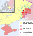
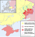
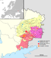
File:2014 Russo-ukrainian-conflict map.svg
外觀

此 SVG 檔案的 PNG 預覽的大小:552 × 599 像素。 其他解析度:221 × 240 像素 | 442 × 480 像素 | 707 × 768 像素 | 943 × 1,024 像素 | 1,886 × 2,048 像素 | 4,126 × 4,480 像素。
原始檔案 (SVG 檔案,表面大小:4,126 × 4,480 像素,檔案大小:2.75 MB)
檔案歷史
點選日期/時間以檢視該時間的檔案版本。
| 日期/時間 | 縮圖 | 尺寸 | 使用者 | 備註 | |
|---|---|---|---|---|---|
| 2014年9月16日 (二) 14:04 |  | 4,126 × 4,480(2.71 MB) | Hanibal911 | Pervomaisk not under control Government troops | |
| 2014年9月16日 (二) 11:13 |  | 4,126 × 4,480(2.72 MB) | Mondolkiri1 | Corrected Pervomaisk per sources in Timeline of the war in Donbass concerning to Pervomaisk and Pervomaisk, Luhansk Oblast | |
| 2014年9月14日 (日) 22:49 |  | 4,126 × 4,480(2.71 MB) | Mondolkiri1 | Reverted to version as of 02:11, 14 September 2014 I changed according to the sources I've used in the file I talked about. You, on the other hand, didn't indicate any source | |
| 2014年9月14日 (日) 11:03 |  | 4,126 × 4,480(2.68 MB) | Niele~commonswiki | * Conflicting reports on status Sartanan, Talakivka push, still fighting * Reverted non-reliable/sourced boundery to rivers changes * No reliable sources for surrounding of Donetsk airport and Debal'tseve. More reliable sources denying it as false... *... | |
| 2014年9月14日 (日) 02:11 |  | 4,126 × 4,480(2.71 MB) | Mondolkiri1 | Updating according to East Ukraine Conflict.svg, apart from the locations where there is fight but are actually under control of one of the sides. Also taking into account sources concerning to Iryna Dovhan, concerning to Yasynuvata and Mariupol | |
| 2014年9月12日 (五) 16:34 |  | 4,126 × 4,480(2.68 MB) | Niele~commonswiki | Updated colors towns/villages to present situation | |
| 2014年9月12日 (五) 16:33 |  | 4,126 × 4,480(2.68 MB) | Niele~commonswiki | Updated colors towns/villages to present situation | |
| 2014年9月11日 (四) 19:29 |  | 4,126 × 4,480(2.68 MB) | Niele~commonswiki | smaller in with, removed a white spot,... | |
| 2014年9月11日 (四) 18:16 |  | 4,309 × 4,503(2.68 MB) | Niele~commonswiki | sorry, new in working with inktscape, SVG This one should be better... | |
| 2014年9月11日 (四) 17:51 |  | 744 × 1,052(2.67 MB) | Niele~commonswiki | User created page with UploadWizard |
檔案用途
沒有使用此檔案的頁面。
全域檔案使用狀況
以下其他 wiki 使用了這個檔案:
- af.wikipedia.org 的使用狀況
- bn.wikipedia.org 的使用狀況
- cs.wikipedia.org 的使用狀況
- de.wikipedia.org 的使用狀況
- en.wikipedia.org 的使用狀況
- fi.wikipedia.org 的使用狀況
- he.wikipedia.org 的使用狀況
- incubator.wikimedia.org 的使用狀況
- it.wikiquote.org 的使用狀況
- ja.wikipedia.org 的使用狀況
- ka.wikipedia.org 的使用狀況
- lv.wikipedia.org 的使用狀況
- mk.wikipedia.org 的使用狀況
- ne.wikipedia.org 的使用狀況
- nl.wikipedia.org 的使用狀況
- pt.wikipedia.org 的使用狀況
- ru.wikinews.org 的使用狀況
- ru.wikiquote.org 的使用狀況
- sd.wikipedia.org 的使用狀況
- te.wikipedia.org 的使用狀況
- uk.wikipedia.org 的使用狀況
- uk.wikiquote.org 的使用狀況
- vi.wikipedia.org 的使用狀況


