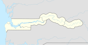
萨拉昆达
外观
| Serekunda | |
|---|---|
 | |
| 坐标:13°26′42″N 16°40′30″W / 13.445°N 16.675°W | |
| 国家 | |
| 一级行政区 | 班珠尔市 |
| 人口[1] | |
| • 总计 | ~337,000人 |

萨拉昆达(阿拉伯语:سيريكوندا)是冈比亚的最大城市[2]。
萨拉昆达濒临大西洋,位于首都班珠尔市之西南方13 km(8 mi)处[3]﹑。该市是由9个聚落集结为较大的都会区。
萨拉昆达的原文指“谢列尔人之家”,也是纪念该市的开拓者Sayerr Jobe[3]。
友好城市
附加图像
-
Mosque on Bundung Highway
参考文献
- ^ Gambia town information.
- ^ Introducing Serekunda & the Atlantic Coast. Lonely Planet. [29 May 2014].
- ^ 3.0 3.1 Serrekunda Town, Gambia. Access Gambia. [2015-07-15].
外部链接
13°26′N 16°40′W / 13.433°N 16.667°W
| 这是一篇与非洲相关的地理小作品。您可以通过编辑或修订扩充其内容。 |


