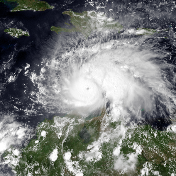
File:Matthew 2016-09-30 1845Z.png
外观

本预览的尺寸:600 × 600像素。 其他分辨率:240 × 240像素 | 480 × 480像素 | 768 × 768像素 | 1,024 × 1,024像素 | 1,600 × 1,600像素。
原始文件 (1,600 × 1,600像素,文件大小:3.82 MB,MIME类型:image/png)
文件历史
点击某个日期/时间查看对应时刻的文件。
| 日期/时间 | 缩略图 | 大小 | 用户 | 备注 | |
|---|---|---|---|---|---|
| 当前 | 2016年10月1日 (六) 03:36 |  | 1,600 × 1,600(3.82 MB) | Pierre cb | {{Information |Description ={{en|1=Visible satellite image of Matthew as a category 4 hurricane at 1825 UTC on Septembre 30,2016, just off the coast of Columbia. The eye is clearly visible.}} |Source =http://www.nrlmry.navy.mil/archdat/test/... |
文件用途
以下页面使用本文件:
全域文件用途
以下其他wiki使用此文件:
- de.wikipedia.org上的用途
- en.wikipedia.org上的用途
- es.wikipedia.org上的用途
- fa.wikipedia.org上的用途
- hu.wikipedia.org上的用途
- ja.wikipedia.org上的用途
- pt.wikipedia.org上的用途
- th.wikipedia.org上的用途


