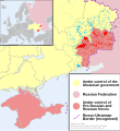
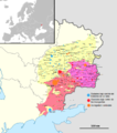
File:2014 Russo-ukrainian-conflict map.svg
外觀

此 SVG 檔案的 PNG 預覽的大小:552 × 599 像素。 其他解析度:221 × 240 像素 | 442 × 480 像素 | 707 × 768 像素 | 943 × 1,024 像素 | 1,886 × 2,048 像素 | 4,126 × 4,480 像素。
原始檔案 (SVG 檔案,表面大小:4,126 × 4,480 像素,檔案大小:2.75 MB)
檔案歷史
點選日期/時間以檢視該時間的檔案版本。
| 日期/時間 | 縮圖 | 尺寸 | 使用者 | 備註 | |
|---|---|---|---|---|---|
| 目前 | 2014年10月9日 (四) 16:03 |  | 4,126 × 4,480(2.75 MB) | Mondolkiri1 | Marinka and Novotroitske - http://militarymaps.info/ |
| 2014年10月9日 (四) 03:27 |  | 4,126 × 4,480(2.75 MB) | Mondolkiri1 | Update according to http://militarymaps.info/ and other sources provided in File:East Ukraine Conflict.svg | |
| 2014年10月6日 (一) 23:30 |  | 4,126 × 4,480(2.74 MB) | Mondolkiri1 | Corrected Zolote and added Novoslapa | |
| 2014年10月6日 (一) 23:20 |  | 4,126 × 4,480(2.74 MB) | Mondolkiri1 | Update according to http://militarymaps.info/ , http://www.segodnya.ua/regions/donetsk/moskal-boeviki-obyavili-na-menya-ohotu-558223.html and other sources in my talk page | |
| 2014年10月5日 (日) 07:13 |  | 4,126 × 4,480(2.74 MB) | Mondolkiri1 | Update Donbass according to File:East Ukraine Conflict.svg | |
| 2014年9月19日 (五) 17:50 |  | 4,126 × 4,480(2.73 MB) | Hanibal911 | POV Vandalism I revert all unjustified changes which was made based unreliable sources | |
| 2014年9月19日 (五) 07:46 |  | 4,126 × 4,480(2.71 MB) | Niele~commonswiki | - Added Lutuhyne tot the red area as suggested by user Mondolkiri1 - Updated legenda and unclear/conflicting report-colours. This was a constructive way to prevent discussions, edit warring on basis of conflicting sources | |
| 2014年9月18日 (四) 13:26 |  | 4,126 × 4,480(2.73 MB) | Hanibal911 | POV Pushing we not use this not correct maps which contradicts to many sources | |
| 2014年9月18日 (四) 13:01 |  | 4,126 × 4,480(2.7 MB) | Niele~commonswiki | Not true, http://mediarnbo.org/ is the official communication-website of Ukrainean Forces, while http://liveuamap.com is unofficial map hosted from the us.Reverted to version as of 12:40, 18 September 2014 | |
| 2014年9月18日 (四) 12:44 |  | 4,126 × 4,480(2.73 MB) | Mondolkiri1 | Reverted to version as of 12:32, 18 September 2014 Sorry, but the http://liveuamap.com/ is the official Ukrainian ATO site, and as I said, Lutuhyne is in the pink area there, not in the foggy zone! |
檔案用途
沒有使用此檔案的頁面。
全域檔案使用狀況
以下其他 wiki 使用了這個檔案:
- af.wikipedia.org 的使用狀況
- bn.wikipedia.org 的使用狀況
- cs.wikipedia.org 的使用狀況
- de.wikipedia.org 的使用狀況
- en.wikipedia.org 的使用狀況
- fi.wikipedia.org 的使用狀況
- he.wikipedia.org 的使用狀況
- incubator.wikimedia.org 的使用狀況
- it.wikiquote.org 的使用狀況
- ja.wikipedia.org 的使用狀況
- ka.wikipedia.org 的使用狀況
- lv.wikipedia.org 的使用狀況
- mk.wikipedia.org 的使用狀況
- ne.wikipedia.org 的使用狀況
- nl.wikipedia.org 的使用狀況
- pt.wikipedia.org 的使用狀況
- ru.wikinews.org 的使用狀況
- ru.wikiquote.org 的使用狀況
- sd.wikipedia.org 的使用狀況
- te.wikipedia.org 的使用狀況
- uk.wikipedia.org 的使用狀況
- uk.wikiquote.org 的使用狀況
- vi.wikipedia.org 的使用狀況


