File:Geolocation.png
外觀

預覽大小:800 × 589 像素。 其他解析度:320 × 236 像素 | 640 × 471 像素 | 1,024 × 754 像素 | 1,280 × 943 像素 | 1,536 × 1,131 像素。
原始檔案 (1,536 × 1,131 像素,檔案大小:406 KB,MIME 類型:image/png)
檔案歷史
點選日期/時間以檢視該時間的檔案版本。
| 日期/時間 | 縮圖 | 尺寸 | 使用者 | 備註 | |
|---|---|---|---|---|---|
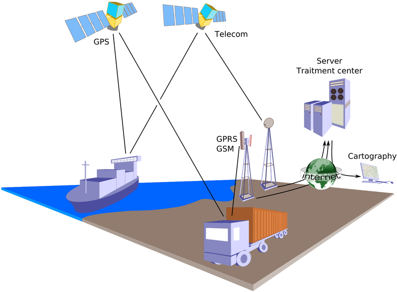
| 目前 | 2009年12月31日 (四) 17:48 |  | 1,536 × 1,131(406 KB) | Éric Chassaing | {{Information |Description={{en|1=Principle of geolocation with GPS. Data transmitted on real-time by telecom satellites or GSM/GPRS network.}} {{fr|1=Principe de géolocalisation par GPS. Données transmises en temps réel par le réseau de satellite de |
檔案用途
下列頁面有用到此檔案:
全域檔案使用狀況
以下其他 wiki 使用了這個檔案:
- ar.wikipedia.org 的使用狀況
- ca.wikipedia.org 的使用狀況
- cs.wikipedia.org 的使用狀況
- de.wikipedia.org 的使用狀況
- en.wikipedia.org 的使用狀況
- eu.wikipedia.org 的使用狀況
- fa.wikipedia.org 的使用狀況
- fr.wikipedia.org 的使用狀況
- id.wikipedia.org 的使用狀況
- is.wikipedia.org 的使用狀況
- it.wikipedia.org 的使用狀況
- ja.wikipedia.org 的使用狀況
- lt.wikipedia.org 的使用狀況
- ro.wikipedia.org 的使用狀況


