Acedera: Difference between revisions
Appearance
Content deleted Content added
No edit summary |
No edit summary |
||
| (33 intermediate revisions by 21 users not shown) | |||
| Line 1: | Line 1: | ||
{{about|the village|the Filipino general|Arnulfo E. Acedera}} |
|||
{{Infobox settlement | |
|||
{{Infobox settlement |
|||
official_name = Acedera | |
|||
| official_name = Acedera |
|||
nickname = | |
|||
| nickname = |
|||
image_flag = | |
|||
| image_skyline = BA-Acedera 01.jpg |
|||
image_seal = | |
|||
| image_alt = Town Hall |
|||
image_map = | |
|||
| image_caption = Town Hall |
|||
map_caption = | |
|||
| image_flag = |
|||
subdivision_type = [[List of countries|Country]] | |
|||
| image_shield = Escudo de Acedera.svg |
|||
subdivision_name = [[Spain]] | |
|||
| image_map = |
|||
subdivision_type1 = [[Autonomous communities of Spain|Autonomous community]] | |
|||
| map_caption = |
|||
subdivision_name1 = [[Extremadura]] | |
|||
| pushpin_map = Spain Extremadura |
|||
subdivision_type2 = [[Provinces of Spain|Province]] | |
|||
| pushpin_label_position = |
|||
subdivision_name2 = [[Badajoz (province)|Badajoz]] | |
|||
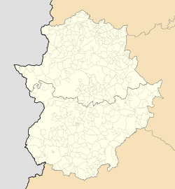
| pushpin_map_caption = Location of Acedera within Extremadura |
|||
subdivision_type3 = [[Comarcas of Spain|Comarca]] | |
|||
| coordinates = {{coord|39|04|37|N|5|34|20|W|region:ES_type:city|display=inline}} |
|||
subdivision_name3 = [[Las Vegas Altas]] | |
|||
| subdivision_type = [[List of countries|Country]] |
|||
leader_title = | |
|||
| subdivision_name = [[Spain]] |
|||
leader_name = | |
|||
| subdivision_type1 = [[Autonomous communities of Spain|Autonomous community]] |
|||
area_magnitude = | |
|||
| subdivision_name1 = [[Extremadura]] |
|||
area_total_km2 = 82.5 | |
|||
| subdivision_type2 = [[Provinces of Spain|Province]] |
|||
area_land_km2 = | |
|||
| subdivision_name2 = [[Badajoz (province)|Badajoz]] |
|||
area_water_km2 = | |
|||
| subdivision_type3 = [[Comarcas of Spain|Comarca]] |
|||
elevation_m = 314 | |
|||
| subdivision_name3 = [[Las Vegas Altas]] |
|||
population_as_of = 2007 | |
|||
| leader_title = |
|||
population_note = | |
|||
| leader_name = |
|||
population_total = 842 | |
|||
| area_magnitude = |
|||
population_density_km2 = | |
|||
| area_total_km2 = 82.5 |
|||
timezone = [[Central European Time|CET]] | |
|||
| area_land_km2 = |
|||
utc_offset = +1 | |
|||
| area_water_km2 = |
|||
timezone_DST = [[Central European Summer Time|CEST]] | |
|||
| elevation_m = 314 |
|||
utc_offset_DST = +2 | |
|||
| population_note = |
|||
latitude = | |
|||
| population_as_of = {{Spain metadata Wikidata|population_as_of}} |
|||
longitude = | |
|||
| population_footnotes = {{Spain metadata Wikidata|population_footnotes}} |
|||
website = | |
|||
| population_total = {{Spain metadata Wikidata|population_total}} |
|||
footnotes = | |
|||
| population_density_km2 = |
|||
}} |
|||
| timezone = [[Central European Time|CET]] |
|||
'''Acedera''' is a [[Spain|Spanish]] [[List of municipalities in Badajoz|municipality]] in the province of [[Badajoz (province)|Badajoz]], [[Extremadura]]. It has a population of 842 (2007) and an area of 82.5 km². |
|||
| utc_offset = +1 |
|||
| timezone_DST = [[Central European Summer Time|CEST]] |
|||
| utc_offset_DST = +2 |
|||
| latitude = |
|||
| longitude = |
|||
| website = |
|||
| footnotes = |
|||
| }} |
|||
'''Acedera''' is a Spanish [[List of municipalities in Badajoz|municipality]] in the province of [[Badajoz (province)|Badajoz]], [[Extremadura]]. It has a population of 842 (2007) and an area of 82.5 km<sup>2</sup>. |
|||
==References== |
|||
{{Municipalities in Badajoz}} |
|||
{{reflist}} |
|||
{{Coord|39|5|0|N|5|34|0|W|type:adm3rd_region:ES_source:nlwiki|display=title}} |
{{Coord|39|5|0|N|5|34|0|W|type:adm3rd_region:ES_source:nlwiki|display=title}} |
||
{{Municipalities in Badajoz}} |
|||
{{authority control}} |
|||
[[Category:Municipalities in Badajoz]] |
[[Category:Municipalities in the Province of Badajoz]] |
||
{{Extremadura-geo-stub}} |
|||
{{Badajoz-geo-stub}} |
|||
[[ar:أسيديرا]] |
|||
[[roa-rup:Acedera]] |
|||
[[ca:Acedera]] |
|||
[[es:Acedera (Badajoz)]] |
|||
[[eo:Acedera (Badajoz)]] |
|||
[[ext:Aceera]] |
|||
[[eu:Acedera]] |
|||
[[fr:Acedera]] |
|||
[[it:Acedera]] |
|||
[[lad:Acedera]] |
|||
[[mk:Аседера]] |
|||
[[nl:Acedera]] |
|||
[[pl:Acedera]] |
|||
[[pt:Acedera]] |
|||
[[ro:Acedera]] |
|||
[[ru:Аседера]] |
|||
[[war:Acedera]] |
|||
Latest revision as of 17:17, 18 August 2024
Acedera | |
|---|---|
 Town Hall | |
| Coordinates: 39°04′37″N 5°34′20″W / 39.07694°N 5.57222°W | |
| Country | Spain |
| Autonomous community | Extremadura |
| Province | Badajoz |
| Comarca | Las Vegas Altas |
| Area | |
• Total | 82.5 km2 (31.9 sq mi) |
| Elevation | 314 m (1,030 ft) |
| Population (2018)[1] | |
• Total | 798 |
| Time zone | UTC+1 (CET) |
| • Summer (DST) | UTC+2 (CEST) |
Acedera is a Spanish municipality in the province of Badajoz, Extremadura. It has a population of 842 (2007) and an area of 82.5 km2.
References
[edit]- ^ Municipal Register of Spain 2018. National Statistics Institute.
39°5′0″N 5°34′0″W / 39.08333°N 5.56667°W


