Umm Al Qubur: Difference between revisions
Appearance
Content deleted Content added
Adding geodata: {{coord missing|Qatar}} |
m Elspamo4 moved page Umm al Qubur to Umm Al Qubur over redirect: Capitalization of name Tags: Mobile edit Mobile web edit Advanced mobile edit |
||
| (14 intermediate revisions by 9 users not shown) | |||
| Line 1: | Line 1: | ||
{{Infobox settlement |
|||
'''Umm al Qubur''' is a settlement in [[Qatar]], located in the [[municipalities of Qatar|municipality]] of [[Ash Shamal]]. |
|||
<!--See the Table at Infobox Settlement for all fields and descriptions of usage--> |
|||
<!-- Basic info ----------------> |
|||
|official_name = Umm al Qubur |
|||
|other_name = |
|||
|native_name = القبور |
|||
|nickname = |
|||
|settlement_type = Abandoned village |
|||
|motto = |
|||
<!-- images and maps -----------> |
|||
|image_skyline = |
|||
|imagesize = |
|||
|image_caption = |
|||
|image_flag = |
|||
|flag_size = |
|||
|image_seal = |
|||
|seal_size = |
|||
|image_shield = |
|||
|shield_size = |
|||
|image_blank_emblem = |
|||
|blank_emblem_type = |
|||
|blank_emblem_size = |
|||
|image_map = |
|||
|mapsize = |
|||
|map_caption = |
|||
|image_map1 = |
|||
|mapsize1 = |
|||
|map_caption1 = |
|||
|image_dot_map = |
|||
|dot_mapsize = |
|||
|dot_map_caption = |
|||
|dot_x = |dot_y = |
|||
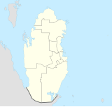
|pushpin_map = Qatar<!-- the name of a location map as per http://en.wikipedia.org/wiki/Template:Location_map --> |
|||
|pushpin_label_position =bottom |
|||
|pushpin_map_caption =Location in Qatar |
|||
|pushpin_mapsize = 160 |
|||
<!-- Location ------------------> |
|||
|subdivision_type = Country |
|||
|subdivision_name = {{QAT}} |
|||
|subdivision_type1 = [[Municipalities of Qatar|Municipality]] |
|||
|subdivision_name1 = [[Ash Shamal]] |
|||
|subdivision_type2 = |
|||
|subdivision_name2 = |
|||
|subdivision_type3 = |
|||
|subdivision_name3 = |
|||
|subdivision_type4 = |
|||
|subdivision_name4 = |
|||
<!-- Politics -----------------> |
|||
|government_footnotes = |
|||
|government_type = |
|||
|leader_title = |
|||
|leader_title1 = <!-- for places with, say, both a mayor and a city manager --> |
|||
|leader_name1 = |
|||
|leader_title2 = |
|||
|leader_name2 = |
|||
|leader_title3 = |
|||
|leader_name3 = |
|||
|leader_title4 = |
|||
|leader_name4 = |
|||
|established_title = <!-- Settled --> |
|||
|established_date = |
|||
|established_title2 = <!-- Incorporated (town) --> |
|||
|established_date2 = |
|||
|established_title3 = <!-- Incorporated (city) --> |
|||
|established_date3 = |
|||
<!-- Area ---------------------> |
|||
|area_magnitude = |
|||
|unit_pref =Imperial <!--Enter: Imperial, if Imperial (metric) is desired--> |
|||
|area_footnotes = |
|||
|area_total_km2 = <!-- ALL fields dealing with a measurements are subject to automatic unit conversion--> |
|||
|area_land_km2 = <!--See table @ Template:Infobox Settlement for details on automatic unit conversion--> |
|||
|area_water_km2 = |
|||
|area_total_sq_mi = |
|||
|area_land_sq_mi = |
|||
|area_water_sq_mi = |
|||
|area_water_percent = |
|||
|area_urban_km2 = |
|||
|area_urban_sq_mi = |
|||
|area_metro_km2 = |
|||
|area_metro_sq_mi = |
|||
|area_blank1_title = |
|||
|area_blank1_km2 = |
|||
|area_blank1_sq_mi = |
|||
<!-- Population -----------------------> |
|||
|population_as_of = |
|||
|population_footnotes = |
|||
|population_note = |
|||
|population_total = |
|||
|population_density_km2 = |
|||
|population_density_sq_mi = |
|||
|population_metro = |
|||
|population_density_metro_km2 = |
|||
|population_density_metro_sq_mi = |
|||
|population_urban = |
|||
|population_density_urban_km2 = |
|||
|population_density_urban_sq_mi = |
|||
|population_blank1_title =Ethnicities |
|||
|population_blank1 = |
|||
|population_blank2_title =Religions |
|||
|population_blank2 = |
|||
|population_density_blank1_km2 = |
|||
|population_density_blank1_sq_mi = |
|||
<!-- General information ---------------> |
|||
|timezone = |
|||
|utc_offset = |
|||
|timezone_DST = |
|||
|utc_offset_DST = |
|||
|coordinates = {{coord|25|52|19|N|51|4|22|E|region:QA|display=inline,title}} |
|||
|elevation_footnotes = <!--for references: use <ref> </ref> tags--> |
|||
|elevation_m = |
|||
|elevation_ft = |
|||
<!-- Area/postal codes & others --------> |
|||
|postal_code_type = <!-- enter ZIP code, Postcode, Post code, Postal code... --> |
|||
|postal_code = |
|||
|area_code = |
|||
|blank_name = |
|||
|blank_info = |
|||
|blank1_name = |
|||
|blank1_info = |
|||
|website = |
|||
|footnotes = |
|||
}} |
|||
'''Umm Al Qubur''' ({{langx|ar|القبور}}) is an abandoned village in [[Qatar]], located in the [[municipalities of Qatar|municipality]] of [[Ash Shamal]]. Archaeological excavations have been carried out on the site.<ref>{{cite book|title=Qatar 2015 Petit Futé (avec cartes, photos + avis des lecteurs)|url=https://books.google.com/books?id=a_gQBQAAQBAJ&pg=PA131 |author=Dominique Auzias |author2=Jean-Paul Labourdette |publisher=Petit Futé|language=fr|year=2014|page=131| isbn=978-2-7469-7856-0 }}</ref> Its name translates to 'mother of graves'.<ref>{{cite web|url=http://geoportal.gisqatar.org.qa/qmap/index.html|title=GIS Portal|publisher=Ministry of Municipality and Environment|access-date=10 August 2017}}</ref> |
|||
{{Qatar-geo-stub}} |
|||
==History== |
|||
{{coord missing|Qatar}} |
|||
Based on field work carried out by anthropologists in Qatar in the 1950s, the main tribe in the area of Umm Al Qubur were the ''Al Jafali'' tribe.<ref name="klaus">{{cite book|last1=Ferdinand|first1=Klaus|last2=Carlsberg Foundation's Nomad Research Project|title=Bedouins of Qatar|publisher=Thames & Hudson|year=1993|page=51|isbn=978-0500015735}}</ref> |
|||
==References== |
|||
[[Category:Cities, towns and villages in Qatar]] |
|||
{{reflist}} |
|||
[[Category:Al Shamal]] |
|||
{{Al Shamal Municipality}} |
|||
{{Qatar-geo-stub}} |
|||
Latest revision as of 03:07, 3 November 2024
Umm al Qubur
القبور | |
|---|---|
Abandoned village | |
| Coordinates: 25°52′19″N 51°4′22″E / 25.87194°N 51.07278°E | |
| Country | |
| Municipality | Ash Shamal |
Umm Al Qubur (Arabic: القبور) is an abandoned village in Qatar, located in the municipality of Ash Shamal. Archaeological excavations have been carried out on the site.[1] Its name translates to 'mother of graves'.[2]
History
[edit]Based on field work carried out by anthropologists in Qatar in the 1950s, the main tribe in the area of Umm Al Qubur were the Al Jafali tribe.[3]
References
[edit]- ^ Dominique Auzias; Jean-Paul Labourdette (2014). Qatar 2015 Petit Futé (avec cartes, photos + avis des lecteurs) (in French). Petit Futé. p. 131. ISBN 978-2-7469-7856-0.
- ^ "GIS Portal". Ministry of Municipality and Environment. Retrieved 10 August 2017.
- ^ Ferdinand, Klaus; Carlsberg Foundation's Nomad Research Project (1993). Bedouins of Qatar. Thames & Hudson. p. 51. ISBN 978-0500015735.

