Hasuliya: Difference between revisions
Appearance
Content deleted Content added
Adding geodata: {{coord|28.58|N|80.83|E|type:adm2_region:NP_source:unmaps-enwiki|display=title}} |
Replacing geodata: {{coord|28.58|N|80.83|E|type:adm2nd_region:NP_source:unmaps-enwiki|display=title}} |
||
| Line 133: | Line 133: | ||
{{ Kailali District}} |
{{ Kailali District}} |
||
{{coord|28.58|N|80.83|E|type: |
{{coord|28.58|N|80.83|E|type:adm2nd_region:NP_source:unmaps-enwiki|display=title}} |
||
[[Category:Cities, towns and villages in Kailali District]] |
[[Category:Cities, towns and villages in Kailali District]] |
||
Revision as of 13:09, 24 October 2009
Hasuliya | |
|---|---|
 | |
| Country | |
| Zone | Seti Zone |
| District | Kailali District |
| Population (1991) | |
• Total | 10,638 |
| Time zone | UTC+5:45 (Nepal Time) |
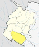
Hasuliya is a Village Development Committee in Kailali District in the Seti Zone of western Nepal. At the time of the 1991 Nepal census it had a population of 10638 residing in 1405 individual households.[1]
References
- ^ "Nepal Census 2001", Nepal's Village Development Committees, Digital Himalaya, retrieved 1 January 2025.

