Kum (mountain): Difference between revisions
Appearance
Content deleted Content added
| map = Slovenia |
template |
||
| Line 18: | Line 18: | ||
| map = Slovenia |
| map = Slovenia |
||
}} |
}} |
||
'''Kum''' ({{IPA-sl|ˈkuːm|pron}}; {{lang-de|Kumberg}}<ref name="Leksikon">[http://www.ff.uni-lj.si/oddelki/Zgodovin/Repertoriji/Kranjska%201900.pdf ''Leksikon občin kraljestev in dežel zastopanih v državnem zboru,'' vol. 6: ''Kranjsko''. 1906. Vienna: C. Kr. Dvorna in Državna Tiskarna, p. 89.] {{webarchive|url=https://web.archive.org/web/20130605183723/http://www.ff.uni-lj.si/oddelki/Zgodovin/Repertoriji/Kranjska%201900.pdf |date=2013-06-05 }} {{sl icon}}</ref>) is the highest peak in the [[Slovenia|Slovenian]] [[Sava Hills]]. Its summit is at |
'''Kum''' ({{IPA-sl|ˈkuːm|pron}}; {{lang-de|Kumberg}}<ref name="Leksikon">[http://www.ff.uni-lj.si/oddelki/Zgodovin/Repertoriji/Kranjska%201900.pdf ''Leksikon občin kraljestev in dežel zastopanih v državnem zboru,'' vol. 6: ''Kranjsko''. 1906. Vienna: C. Kr. Dvorna in Državna Tiskarna, p. 89.] {{webarchive|url=https://web.archive.org/web/20130605183723/http://www.ff.uni-lj.si/oddelki/Zgodovin/Repertoriji/Kranjska%201900.pdf |date=2013-06-05 }} {{sl icon}}</ref>) is the highest peak in the [[Slovenia|Slovenian]] [[Sava Hills]]. Its summit is at {{convert|1220|m|sp=us}} above sea level. The mountain is also called the "Sava Triglav" because it is the highest peak in the region. There are a number of structures at the summit, notably a church dedicated to [[Saint Agnes]] from the 17th century and a transmitter. It belongs to the settlement of [[Ključevica]]. |
||
== See also == |
== See also == |
||
Revision as of 14:44, 27 July 2019
You can help expand this article with text translated from the corresponding article in Slovene. (December 2011) Click [show] for important translation instructions.
|
| Kum | |
|---|---|
 The church and transmitter at the top of Kum | |
| Highest point | |
| Elevation | 1,220 m (4,000 ft)[1] |
| Coordinates | 46°5′16.28″N 15°4′22.72″E / 46.0878556°N 15.0729778°E[1] |
| Geography | |
| Parent range | Sava Hills |
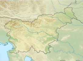
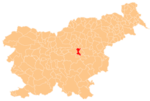
Kum (pronounced [ˈkuːm]; Template:Lang-de[2]) is the highest peak in the Slovenian Sava Hills. Its summit is at 1,220 meters (4,000 ft) above sea level. The mountain is also called the "Sava Triglav" because it is the highest peak in the region. There are a number of structures at the summit, notably a church dedicated to Saint Agnes from the 17th century and a transmitter. It belongs to the settlement of Ključevica.
See also
References
External links
 Media related to Kum at Wikimedia Commons


