Cape Pine: Difference between revisions
Appearance
Content deleted Content added
Replacing geodata: {{coord|46|36|55.44|N|53|31|54.35|W|region:CA_type:landmark|display=title}} |
|||
| Line 14: | Line 14: | ||
{{lighthouse-stub}} |
{{lighthouse-stub}} |
||
{{ |
{{coord|46|36|55.44|N|53|31|54.35|W|region:CA_type:landmark|display=title}} |
||
{{DEFAULTSORT:Pine, Cape}} |
{{DEFAULTSORT:Pine, Cape}} |
||
Revision as of 12:16, 24 September 2008
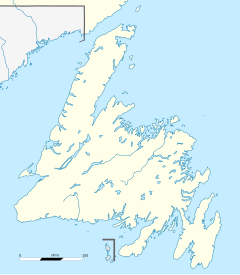
Location of Cape Pine in Newfoundland
The Headland of Cape Pine is the point of land marking the boundary of Trepassey Bay on the Avalon Peninsula of the island of Newfoundland in the Canadian province of Newfoundland and Labrador.
It is the most southerly point in Newfoundland; at 46 36' 55" N, it is roughly the same latitude as the northern border of Italy.
Lighthouse
A lighthouse was built on Cape Pine by Alexander Gordon in 1851. It is a cylindrical cast iron tower which today is painted white with red horizontal bands. The last complete painting was undertaken in 2007.
The light characteristic is a white flash every 5 seconds, additionally a fog horn may be sounded every 60 s. The Canadian Coast Guard maintains the site, employing a keeper.
References
- Rowlett, Russ. "The Lighthouse Directory". Retrieved 8 September.
{{cite web}}: Check date values in:|accessdate=(help); Unknown parameter|accessyear=ignored (|access-date=suggested) (help)

