Trier-Land: Difference between revisions
Appearance
Content deleted Content added
Replacing geodata: {{coord|49|45|40|N|6|33|17|E|region:DE-RP_type:city(21551)|display=title}} |
|||
| Line 37: | Line 37: | ||
{{Cities and towns in Trier-Saarburg (district)}} |
{{Cities and towns in Trier-Saarburg (district)}} |
||
[[Category:Verbandsgemeinde in Rhineland-Palatinate]] |
[[Category:Verbandsgemeinde in Rhineland-Palatinate]] |
||
[[Category:Articles lacking sources (Erik9bot)]] |
|||
[[de:Verbandsgemeinde Trier-Land]] |
[[de:Verbandsgemeinde Trier-Land]] |
||
Revision as of 04:39, 9 August 2009
| Arms | Map |
|---|---|

|

|
| Country: | Germany |
| State: | Rhineland-Palatinate |
| District: | Trier-Saarburg |
| Verbandsgemeinde: | Trier-Land |
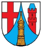
Trier-Land is a Verbandsgemeinde ("collective municipality") in the Trier-Saarburg district, in Rhineland-Palatinate, Germany. It is situated on the border with Luxembourg, north and west of Trier. The seat of the municipality is in Trier, itself not part of the municipality.
The Verbandsgemeinde Trier-Land consists of the following Ortsgemeinden ("local municipalities"):

