Agrestina: Difference between revisions
Appearance
Content deleted Content added
Adding geodata: {{coord|8|27|S|35|57|W|display=title|region:BR_type:city_source:GNS-enwiki}} |
GrouchoBot (talk | contribs) m robot Adding: es:Agrestina |
||
| Line 73: | Line 73: | ||
{{Pernambuco-geo-stub}} |
{{Pernambuco-geo-stub}} |
||
[[es:Agrestina]] |
|||
[[fr:Agrestina]] |
[[fr:Agrestina]] |
||
[[bpy:আগ্রেসটিনা]] |
[[bpy:আগ্রেসটিনা]] |
||
Revision as of 17:23, 19 April 2010

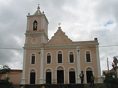
Agrestina (Wilding) is a Brazilian city in the state of Pernambuco, mesoregion of Agreste. Has an estimated population of 22,591 in 2009 in a total territory of 201.44 km2.
Geography
- State - Pernambuco
- Region - Agreste of Pernambuco
- Boundaries - Caruaru and Bezerros (N); Cupira (S); São Joaquim do Monte (E); Altinho (W)
- Area - 201.44 sqkm
- Elevation - 427 m
- Hidrography - Una river
- Vegetation - Hiperxerófila caatinga
- Clima - Transition between tropical (coastal) and semi arid
- Annual average temperature - 23.4 c
- Distance to Recife - 150 km
Economy

The main economic activities in Agrestina are based in general commerce, industry and agribusiness. Especially, manioc and, creations of cattle, goats and sheeps.
Economic Indicators
| Population [1] | GDP x(1000 R$).[2] | GDP pc (R$) | PE |
|---|---|---|---|
| 22.591 | 85.752 | 3.997 | 0.14 % |
Economy by Sector 2006
| Primary sector | Secondary sector | Service sector |
|---|---|---|
| 19.29 % | 12.90 % | 67.81 % |
Health Indicators
| HDI (2000) | Hospitals (2007) | Hospitals beds (2007) | Children's Mortality every 1000 (2005) |
|---|---|---|---|
| 0.612 | 1 | 72 | 33.8 |
References
- ^ http://www.ibge.gov.br/home/estatistica/populacao/estimativa2009/POP2009_DOU.pdf IBGE Population 2009 Agrestina, page 31]
- ^ Agrestina 2007 GDP IBGE pag 29
- ^ PE State site - City by city profile
Wikimedia Commons has media related to Agrestina.
