Nyíregyháza Airport: Difference between revisions
Appearance
Content deleted Content added
No edit summary |
Iridescent (talk | contribs) m →Facilities: Typo fixing, typo(s) fixed: hungarian → Hungarian using AWB |
||
| Line 35: | Line 35: | ||
==Facilities== |
==Facilities== |
||
The airport resides at an [[elevation]] of {{convert|338|ft|0}} above [[mean sea level]]. It has two [[runway]]s: 18R/36L has an [[asphalt]] pavement measuring {{convert|1000|x|20|m|0}} and 18L/36R has a [[grass]] surface measuring {{convert|1000|x|60|m|0}}.<ref name="WAD" /> The airport is the home base of Trener Ltd, a |
The airport resides at an [[elevation]] of {{convert|338|ft|0}} above [[mean sea level]]. It has two [[runway]]s: 18R/36L has an [[asphalt]] pavement measuring {{convert|1000|x|20|m|0}} and 18L/36R has a [[grass]] surface measuring {{convert|1000|x|60|m|0}}.<ref name="WAD" /> The airport is the home base of Trener Ltd, a Hungarian pilot traning organization which together with University of Nyíregyháza (responsible for theoretical training) provides ATPL integrated course and a professional airline pilot degree uniquely in the Middle European Region. |
||
==Airlines and destinations== |
==Airlines and destinations== |
||
Revision as of 17:25, 29 October 2016
Nyíregyháza Airport | |||||||||||||||
|---|---|---|---|---|---|---|---|---|---|---|---|---|---|---|---|
| Summary | |||||||||||||||
| Airport type | Public | ||||||||||||||
| Serves | Nyíregyháza, Hungary | ||||||||||||||
| Elevation AMSL | 338 ft / 103 m | ||||||||||||||
| Coordinates | 47°59′02″N 021°41′32″E / 47.98389°N 21.69222°E | ||||||||||||||
| Website | trenerkft.hu | ||||||||||||||
 | |||||||||||||||
| Runways | |||||||||||||||
| |||||||||||||||
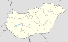
Nyíregyháza Airport (ICAO: LHNY) is a small civil airport serving Nyíregyháza,[1] a city in Szabolcs-Szatmár-Bereg county, Hungary.
Facilities
The airport resides at an elevation of 338 feet (103 m) above mean sea level. It has two runways: 18R/36L has an asphalt pavement measuring 1,000 by 20 metres (3,281 ft × 66 ft) and 18L/36R has a grass surface measuring 1,000 by 60 metres (3,281 ft × 197 ft).[1] The airport is the home base of Trener Ltd, a Hungarian pilot traning organization which together with University of Nyíregyháza (responsible for theoretical training) provides ATPL integrated course and a professional airline pilot degree uniquely in the Middle European Region.
Airlines and destinations
As of May 2016 there are no scheduled services to and from Nyíregyháza.
Statistics
| Year | Passengers[3] | Change |
|---|---|---|
| 2009 | ||
| 2010 | −5.59% | |
| 2011 | −54.42% | |
| 2012 | +27.05% | |
| 2013 | −7.43% | |
| 2014 | −50.57% | |
| 2015 | +248.47% |
References
- ^ a b c Airport information for LHNY from DAFIF (effective October 2006)
- ^ Airport information for LHNY at Great Circle Mapper. Source: DAFIF (effective October 2006).
- ^ "Repülőterek forgalmi adatai (2004-2015)" (in Hungarian). KSH. Retrieved 2016-04-15.

