Kum (mountain): Difference between revisions
Appearance
Content deleted Content added
m Robot - Speedily moving category Mountains in Lower Carniola to Category:Mountains of Lower Carniola per CFDS. |
| map = Slovenia |
||
| Line 16: | Line 16: | ||
| first_ascent = |
| first_ascent = |
||
| easiest_route = |
| easiest_route = |
||
| map = Slovenia |
|||
}} |
}} |
||
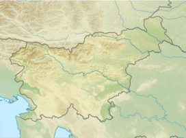
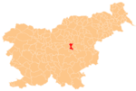
'''Kum''' ({{IPA-sl|ˈkuːm|pron}}; {{lang-de|Kumberg}}<ref name="Leksikon">[http://www.ff.uni-lj.si/oddelki/Zgodovin/Repertoriji/Kranjska%201900.pdf ''Leksikon občin kraljestev in dežel zastopanih v državnem zboru,'' vol. 6: ''Kranjsko''. 1906. Vienna: C. Kr. Dvorna in Državna Tiskarna, p. 89.] {{webarchive|url=https://web.archive.org/web/20130605183723/http://www.ff.uni-lj.si/oddelki/Zgodovin/Repertoriji/Kranjska%201900.pdf |date=2013-06-05 }} {{sl icon}}</ref>) is the highest peak in the [[Slovenia|Slovenian]] [[Sava Hills]]. Its summit is at 1,220 m above sea level. The mountain is also called the "Sava Triglav" because it is the highest peak in the region. There are a number of structures at the summit, notably a church dedicated to [[Saint Agnes]] from the 17th century and a transmitter. It belongs to the settlement of [[Ključevica]]. |
'''Kum''' ({{IPA-sl|ˈkuːm|pron}}; {{lang-de|Kumberg}}<ref name="Leksikon">[http://www.ff.uni-lj.si/oddelki/Zgodovin/Repertoriji/Kranjska%201900.pdf ''Leksikon občin kraljestev in dežel zastopanih v državnem zboru,'' vol. 6: ''Kranjsko''. 1906. Vienna: C. Kr. Dvorna in Državna Tiskarna, p. 89.] {{webarchive|url=https://web.archive.org/web/20130605183723/http://www.ff.uni-lj.si/oddelki/Zgodovin/Repertoriji/Kranjska%201900.pdf |date=2013-06-05 }} {{sl icon}}</ref>) is the highest peak in the [[Slovenia|Slovenian]] [[Sava Hills]]. Its summit is at 1,220 m above sea level. The mountain is also called the "Sava Triglav" because it is the highest peak in the region. There are a number of structures at the summit, notably a church dedicated to [[Saint Agnes]] from the 17th century and a transmitter. It belongs to the settlement of [[Ključevica]]. |
||
Revision as of 12:16, 27 July 2019
You can help expand this article with text translated from the corresponding article in Slovene. (December 2011) Click [show] for important translation instructions.
|
| Kum | |
|---|---|
 The church and transmitter at the top of Kum | |
| Highest point | |
| Elevation | 1,220 m (4,000 ft)[1] |
| Coordinates | 46°5′16.28″N 15°4′22.72″E / 46.0878556°N 15.0729778°E[1] |
| Geography | |
| Parent range | Sava Hills |
Kum (pronounced [ˈkuːm]; Template:Lang-de[2]) is the highest peak in the Slovenian Sava Hills. Its summit is at 1,220 m above sea level. The mountain is also called the "Sava Triglav" because it is the highest peak in the region. There are a number of structures at the summit, notably a church dedicated to Saint Agnes from the 17th century and a transmitter. It belongs to the settlement of Ključevica.
See also
References
External links
 Media related to Kum at Wikimedia Commons


