Yuli, Hualien
Appearance
Yuli Township
玉里鎮 | |
|---|---|
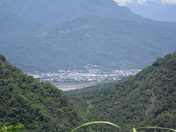
 Aerial view of Yuli Township | |
 | |
| Coordinates: 23°23′15″N 121°22′35″E / 23.38750°N 121.37639°E | |
| Country | Taiwan |
| Region | Eastern Taiwan |
| Government | |
| • Type | Urban Township |
| Area | |
• Total | 252.3719 km2 (97.4413 sq mi) |
| Population (December 2014) | |
• Total | 25,396 |
| Time zone | UTC+8 (CST) |
| Post code | 981 |
| Subdivision | 15 Villages |
| Website | www.hlyl.gov.tw |


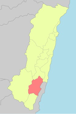
Yuli Township (Chinese: 玉里鎮; pinyin: Yùlǐ Zhèn; Pe̍h-ōe-jī: Gio̍k-lí-tìn) is an urban township located in central Huatung Valley, and also the southern administrative center of Hualien County, Taiwan. It has a population of 25,396 inhabitants and 15 villages.[1]
Geography


The township is located in the Huatung Valley.
Administrative divisions
The township comprises 15 villages: Chunri, Dayu, Dewu, Guanyin, Guowu, Lege, Qimo, Sanmin, Songpu, Taichang, Tungfeng, Yongchang, Yuancheng, Zhangliang and Zhongcheng.
Tourist attractions
- Antong Hot Springs
- Dongfeng Leisure Farm
- Mount Chihke
- Teifen Waterfalls
- Xietian Temple
- Yucyuan Temple
- Yushan National Park[2]
Transportation

Railway
Road
- Provincial Highway No.9 (Hualien-Taitung Highway)
- Provincial Highway No.30 (Yuli-Chengbin Highway)
- County Road No.193
Bus
- Hualien Bus Company
Notable natives
- Evonne Hsieh, actress
- Umin Boya, writer, director and actor
- Wu Maw-kuen, Minister of Education (2018)
Wikimedia Commons has media related to Yuli Township, Hualien County.
References
- ^ "Archived copy". Archived from the original on March 6, 2014. Retrieved February 17, 2014.
{{cite web}}: CS1 maint: archived copy as title (link) - ^ [1]
External links
Wikivoyage has a travel guide for Yuli.
- Office of Yu Li Township (Chinese)


