Chaozhou, Pingtung
| Chaozhou Township | |
|---|---|
| Traditional Chinese | 潮州鎮 |
| Hanyu Pinyin | Cháozhōu Zhèn |
| Tongyong Pinyin | Cháojhou Jhèn |
| Pha̍k-fa-sṳ | Tshèu-chû-tsṳ́n |
| Hokkien POJ | Tiô-chiu-tìn |


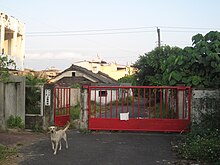
Chaozhou Township[1] (also spelled Chaojhou; Chinese: 潮州鎮)[2] is an urban township in western Pingtung County, Taiwan.
Name
Chaozhou is named after Chaozhou, a city in eastern Guangdong, China. According to some historians, settlers from that city landed here in 1724, and thus named this area after their hometown.
Geography
The township is located in the western side of Pingtung County at the Pingtung Plain. It has an area of 42.43 square kilometres (16.38 sq mi) and a population of 54,738 people as of 2014.
Administrative divisions

The township comprises 21 villages: Baye, Chaozhou, Fuchun, Guangchun, Guanghua, Jiukuai, Luntung, Pengcheng, Penglai, Sangong, Sanhe, Sanxing, Shezi, Sichun, Silin, Tongrong, Wukui, Xingmei, Xinrong, Xinsheng and Yongchun.
Education
Language
All inhabitants speak the Taiwanese Hokkien language. The original Chaozhou language spoken by the inhabitants has now been completely forgotten due to assimilation.[citation needed]
Senior high schools
- National Chao-Chou Senior High School (國立潮州高級中學)
- Jih Hsin Insdustrial and Commercial Vocational Senior School (日新高級工商職業學校)
Junior high schools
- Pingtung County Chaozhou Junior High School (屏東縣立潮州國民中學)
- Pingtung Conty Guangchun Junior High School (屏東縣立光春國民中學)
Primary schools
- Chaozhou Primary School (屏東縣潮州鎮潮州國民小學)
- Guangchun Primary School (屏東縣潮州鎮光春國民小學)
- Silin Primary School (屏東縣潮州鎮四林國民小學)
- Chaonan Primary School (屏東縣潮州鎮潮南國民小學)
- Chaodong Primary School (屏東縣潮州鎮潮東國民小學)
- Chaosheng Primary School (屏東縣潮州鎮潮昇國民小學)
- Guanghua Primary School (屏東縣潮州鎮光華國民小學)
- Chaohe Primary School (屏東縣潮州鎮潮和國民小學)
Tourist attractions
Notable natives
- Chen Bao-ji, Minister of Council of Agriculture (2012-2016)
Transportation

Railway
Highway
 Freeway 3 (Taiwan)
 Provincial Highway 88 (Taiwan)
- Zhutian System Interchange
References
- ^ 臺灣地區鄉鎮市區級以上行政區域名稱中英對照表 Archived 2012-03-25 at the Wayback Machine Glossary of Names for Administrative Divisions. Template:Zh icon Accessed at Taiwan Geographic Names Information System website Archived 2013-08-16 at the Wayback Machine Template:En icon. Ministry of the Interior. 16 June 2011. Retrieved 5 March 2015.
- ^ 鄉鎮中英對照

