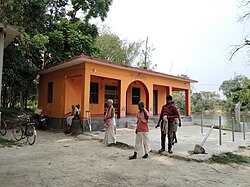
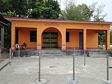
Banauli Donauli
Banauli
बनौली | |
|---|---|
Village | |
| Banauli Raj | |
 Durga Puja Mandir, Banauli | |
| Coordinates: 26°41′N 85°53′E / 26.69°N 85.89°E | |
| Country | |
| Province | Madhesh Pradesh, Mithila region |
| District | Mahottari District |
| Government | |
| • Type | RJPN |
| • Ward Head | MADHUBENDRA JHA |
| Population (2011) | |
• Total | 4,577 |
| Demonym | Maithil |
| National Languages | |
| • Official | Nepali |
| Regional official language | |
| • Mother language | Maithili |
| Time zone | UTC+5:45 (Nepal Time) |


Banauli is a village or Ward No. 07 in Pipra Rural Municipality of Mahottari District in the Madhesh Pradesh (Mithila region) of south-eastern Nepal. At the time of the 2011 Nepal census it had a population of 4577 people living in 944 individual households.[1] It is very near Thakurpati and Jankpurdham city.
In the village the major inhabitants are Maithil Brahmins (highest in Nepal) Bhumihar, Dhanuk, Shahu, Lohar, Mukhiya, Das etc.
Formerly this Village was under Banauli-Donauli Village Development Committee of Mahottari district however after the provincial distribution of the country, it lies in Pipara Rural Municipality of Mahottari district in Madhesh Pradesh. Banauli is also considered as the place where great Maithili Poet Vidyapati lived around twelve years and hence it holds great historical significance. The place where Maithili poet Vidyapati lived is known as Banauli Vidyapati Dih. The site is also claimed as the capital of the Raj Banauli of the King Puraditya of the Dronawara Dynasty in Mithila. This village lies 4 km south of Janakpurdham. The village is connected by the Vidyapati National Highway from Janakpur to the Indo - Nepal border town Matihani via Ekrahiya Village. The Vidyapati National Highway is also connected to the Bhitthamore - Janakpur National Highway at Vidyapati Dwar ( Gate ).[2]
References
[edit]- ^ "Nepal Census 2001", Nepal's Village Development Committees, Digital Himalaya, archived from the original on October 12, 2008, retrieved 15 November 2009.
- ^ Collegenp. "Madhesh Pradesh Govt Policies and Programs for the Fiscal Year 2079/80 | Collegenp". www.collegenp.com. Retrieved 2023-10-20.
External links
[edit]


