Beiji, Heilongjiang
Beiji
北极镇 | |
|---|---|
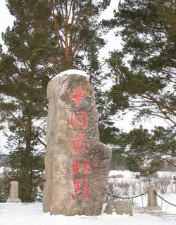
 "Northernmost Place in China" marker | |
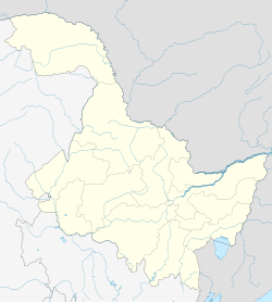
| Coordinates: 53°28′41″N 122°21′12″E / 53.47815°N 122.3534°E | |
| Country | China |
| Province | Heilongjiang |
| Prefecture-level city | Mohe |
| Prefecture | Daxing'anling Prefecture |
| Area | |
• Total | 2,380 km2 (920 sq mi) |
| Population (2020) | |
• Total | 2,373 |
| • Density | 1/km2 (3/sq mi) |
| Time zone | UTC+8 (China Standard) |
| License plate | 黑P |
Beiji (simplified Chinese: 北极镇; traditional Chinese: 北極鎮; pinyin: Běijí Zhèn), formerly Mohe Township, is a town located in Mohe, Daxing'anling Prefecture. It is the northernmost town in China, and is famous for its tourism. Beiji spans an area of about 2,380 square kilometres (920 sq mi).[1] As of 2020[update], Beiji has a population of 2,373,[2] giving it a population density of 1 person per square kilometer.[1]
Climate
[edit]Beiji has a humid continental climate (Dwb) bordering on a subarctic climate (Dwc) with short, warm summers and long, bitterly cold winters.
| Climate data for Beiji Village, Mohe (1991–2020 normals) | |||||||||||||
|---|---|---|---|---|---|---|---|---|---|---|---|---|---|
| Month | Jan | Feb | Mar | Apr | May | Jun | Jul | Aug | Sep | Oct | Nov | Dec | Year |
| Mean daily maximum °C (°F) | −19.6 (−3.3) |
−11.9 (10.6) |
−1.0 (30.2) |
9.3 (48.7) |
18.2 (64.8) |
25.4 (77.7) |
26.8 (80.2) |
23.9 (75.0) |
17.3 (63.1) |
5.5 (41.9) |
−10.2 (13.6) |
−20.9 (−5.6) |
5.2 (41.4) |
| Daily mean °C (°F) | −27.9 (−18.2) |
−23.2 (−9.8) |
−11.4 (11.5) |
1.5 (34.7) |
10.2 (50.4) |
17.2 (63.0) |
19.6 (67.3) |
16.5 (61.7) |
9.0 (48.2) |
−2.0 (28.4) |
−17.9 (−0.2) |
−27.4 (−17.3) |
−3.0 (26.6) |
| Mean daily minimum °C (°F) | −34.1 (−29.4) |
−31.4 (−24.5) |
−21.0 (−5.8) |
−6.3 (20.7) |
2.2 (36.0) |
9.4 (48.9) |
13.5 (56.3) |
11.1 (52.0) |
3.1 (37.6) |
−7.9 (17.8) |
−23.9 (−11.0) |
−32.8 (−27.0) |
−9.8 (14.3) |
| Average precipitation mm (inches) | 4.2 (0.17) |
4.2 (0.17) |
5.1 (0.20) |
21.7 (0.85) |
45.4 (1.79) |
69.8 (2.75) |
105.8 (4.17) |
97.0 (3.82) |
51.7 (2.04) |
24.9 (0.98) |
13.4 (0.53) |
6.3 (0.25) |
449.5 (17.72) |
| Average precipitation days (≥ 0.1 mm) | 6.2 | 5.5 | 3.9 | 5.9 | 11.3 | 13.7 | 15.6 | 15.7 | 11.7 | 7.7 | 8.9 | 7.6 | 113.7 |
| Average snowy days | 7.4 | 6.2 | 4.3 | 4.5 | 0.3 | 0.1 | 0 | 0.1 | 0.7 | 6.7 | 10.3 | 9.4 | 50 |
| Average relative humidity (%) | 68 | 65 | 60 | 53 | 58 | 71 | 78 | 81 | 76 | 71 | 74 | 70 | 69 |
| Mean monthly sunshine hours | 148.7 | 182.0 | 254.0 | 254.7 | 235.2 | 264.2 | 234.8 | 213.2 | 186.1 | 163.5 | 139.5 | 120.7 | 2,396.6 |
| Percent possible sunshine | 59 | 65 | 68 | 60 | 47 | 52 | 46 | 47 | 50 | 51 | 55 | 52 | 54 |
| Source: China Meteorological Administration[3][4] | |||||||||||||
Administrative divisions
[edit]There are three administrative villages in Beiji: Beiji Village (Chinese: 北极村, the northernmost village in China and seat of government), Beihong Village (Chinese: 北红村), and Luoguhe Village (Chinese: 洛古河村).[5]
References
[edit]- ^ a b "黑龙江大兴安岭市漠河市北极镇地名介绍". www.tcmap.com.cn. Retrieved 2021-03-26.
- ^ 人口民族 [Population and Ethnicity] (in Chinese). Mohe Municipal People's Government. Archived from the original on 2024-04-19. Retrieved 2024-09-08.
- ^ 中国气象数据网 – WeatherBk Data (in Simplified Chinese). China Meteorological Administration. Retrieved 8 October 2023.
- ^ 中国气象数据网 (in Simplified Chinese). China Meteorological Administration. Retrieved 8 October 2023.
- ^ 2023年统计用区划代码和城乡划分代码(北极镇) [2023 Statistical Division Codes and Urban-rural Division Codes (Beiji)] (in Chinese). National Bureau of Statistics of China. 2023. Archived from the original on 2024-09-09. Retrieved 2024-09-09.

