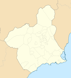
El Plan, Cartagena
El Plan | |
|---|---|
Municipality district | |
| Coordinates: 37°38′25.7034″N 1°0′30.7006″W / 37.640473167°N 1.008527944°W | |
| Country | |
| Autonomous community | |
| Comarca | Campo de Cartagena |
| Judicial district | Cartagena |
| Municipality | Cartagena |
| Government | |
| • Mayor | Ana Belén Castejón Hernández |
| Area | |
• Total | 13.165 km2 (5.083 sq mi) |
| Population ()[1] | |
• Total | 36,080 |
| • Density | 2,700/km2 (7,100/sq mi) |
| Time zone | UTC+1 (CET) |
| • Summer (DST) | UTC+2 (CEST) |
| Postal code | 30310 |
| Dialing code | (+34) 968 |
El Plan is a district of the Spanish municipality Cartagena. It is located in the east of the western half of the municipality,[2] has an area of 13.165 km2,[3] and was inhabited by 36,080 people in 2020.[4]
The localities of the district are La Guía, which is in the north-west and is home to 122 people; Polígono de Santa Ana, where 7154 live; El Plan, which is inhabited by 220 people; Los Gabatos, which is placed in the south-western quarter and has a population of 5626, Barriada Hispanoamérica, which is also located in the south-western quarter and is home to 3865 people; Los Dolores, which is placed in the southern half and is inhabited by 7751 people; Urbanización Castillitos, which is located in the south and has a population of 1384 people; Los Barreros, which is also placed in the south and is home to 7030 people and Barriada Cuatro Santos, which is placed in the south-east end and is inhabited by 2573 people.[2][5]
The district is in an urban continuity with the main city and the northern neighbourhoods of San Antonio Abad district.[3]
Demographics
[edit]7.857% inhabitants are foreigners – 0.848% come from other country of Europe, 5,6% are Africans, 11.14% are Americans and 0,285% are Asians.[6] The table below shows the population trends of the 21st century by its five-year periods.[4]
| 2001 | 2006 | 2011 | 2016 | |
|---|---|---|---|---|
| Population[4] | 30,512 | 43,021 | 44,312 | 44,789 |
Main sights
[edit]- El Castillito: it was built in 1900. It has two stages and its outside walls are red in the upper stage and whitish in the lower stage.[7] A remarkable feature of the building is the presence of two cylindrical towers which are adjacent to the main body.[8]
- El Retiro: it started its existence in 1900.[9]
- Torre Llagostera: it was built in the first two decades of the 20th century.[10]
- Casa Barceló: it was built in 1916.[11]
Festivities
[edit]- Festivity in Los Dolores: it takes place during the first third of September. Some activities such as revere flower placement to the virgin takes place during this festive period.[12][13]
- Festivity in Barriada Hispanoamérica: it is held in the October.[14]
References
[edit]- ^ Municipal Register of Spain 2018. National Statistics Institute.
- ^ a b "Barrios y Diputaciones│Historia│Tu Ciudad│Ayuntamiento de Cartagena" (in Spanish). Archived from the original on 2016-04-02. Retrieved 2020-02-28.
- ^ a b "Ficha de diputación - El Plan - Urbanismo Cartagena" (in Spanish). Archived from the original on 2019-12-30. Retrieved 2021-02-08.
- ^ a b c "INEbase/Demography and population /Municipal Register. Population by Municipality /Nomenclature:Continuous Register Population by Population Unit / Results".
- ^ "INEbase / Demography and population /Municipal Register. Population by municipality /Nomenclature: Continuous Register Population by Population Unit / Results". INE. Retrieved 2021-02-28.
- ^ "CREM - Datos Municipales Cartagena - 7. Población según entidades y nacionalidad (por continentes)". Portal Estadístico de la Región de Murcia - CREM (in Spanish). Archived from the original on 2021-08-06. Retrieved 2021-02-28.
- ^ "Ficha del catálogo de edificios y elementos protegidos" (PDF) (in Spanish). p. 160230. Archived (PDF) from the original on 2017-09-03. Retrieved 2021-03-04.
- ^ "Visitas guiadas al Castillito de Los Dolores durante el fin de semana". Europapress (in Spanish). 2012-03-22. Retrieved 2021-03-06.
- ^ "Ficha del catálogo de edificios y elementos protegidos" (PDF) (in Spanish). p. 160234. Archived (PDF) from the original on 2017-09-03. Retrieved 2021-03-04.
- ^ "Ficha del catálogo de edificios y elementos protegidos" (PDF) (in Spanish). p. 160232. Archived (PDF) from the original on 2017-09-03. Retrieved 2021-03-04.
- ^ "Ficha del catálogo de edificios y elementos protegidos" (PDF) (in Spanish). p. 160458. Archived (PDF) from the original on 2017-09-03. Retrieved 2021-03-04.
- ^ "Fiestas de Los Dolores│Ayuntamiento de Cartagena". Retrieved 2021-03-04.
- ^ "Programa Fiestas Los Dolores-Cartagena 2019 - La Guía W - La Guía Definitiva - Encuentra lo que quieras, donde quieras" (in Spanish). Retrieved 2021-03-04.
- ^ Barriada Hispanoamérica, Asociación de Vecinos. "Fiestas de la Barriada Hispanoamérica - Del 6 al 15 de octubre de 2017" (PDF) (in Spanish). Concejalía de festejos y descentralización del Ayuntamiento de Cartagena. Junta vecinal de Los Dolores. Retrieved 2021-03-04.


