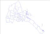
Foro subregion
Appearance
Foro | |
|---|---|
 | |
| Country | |
| Region | Northern Red Sea |
| Capital | Foro |
| Time zone | UTC+3 (GMT +3) |
Foro subregion is a subregion in the Northern Red Sea region (Zoba Foro) of Eritrea. Its capital lies at Foro.
Overview
[edit]The town is situated near the coast. A confluence of the Haddas, Aligide and Comaile River's runs through the district. During the 1960s, there was significant agricultural development on the district's alluvial plains.[1]
Notes
[edit]- ^ Killion, Tom (1998). Historical Dictionary of Eritrea. The Scarecrow Press. ISBN 0-8108-3437-5.

