Haddam Meadows State Park
Appearance
| Haddam Meadows State Park | |
|---|---|
 | |
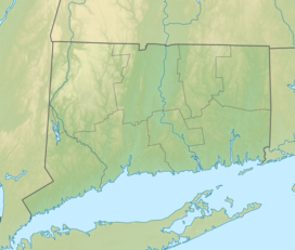
| Location | Haddam, Connecticut, United States |
| Coordinates | 41°28′44″N 72°30′31″W / 41.47889°N 72.50861°W[1] |
| Area | 175 acres (71 ha)[2] |
| Elevation | 3 ft (0.91 m)[1] |
| Established | 1944 |
| Administered by | Connecticut Department of Energy and Environmental Protection |
| Designation | Connecticut state park |
| Website | Official website |
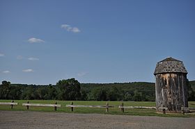
Haddam Meadows State Park is a public recreation area occupying 175 acres (71 ha) on the west bank of the Connecticut River in the town of Haddam, Connecticut. The state park offers picnicking, fishing, and a boat launch.[3][4] Park trails lend access to a diversity of riverside landscapes: marsh, beach, sand bar, fern growths, meadow lands, and hardwood forest.[5] The park was established through the donation of land in 1944 by the Edward W. Hazen Foundation. It is managed by the Connecticut Department of Energy and Environmental Protection.[3]
References
[edit]- ^ a b "Lower Swamp". Geographic Names Information System. United States Geological Survey, United States Department of the Interior.
- ^ "Appendix A: List of State Parks and Forests" (PDF). State Parks and Forests: Funding. Staff Findings and Recommendations. Connecticut General Assembly. January 23, 2014. p. A-2. Retrieved March 20, 2014.
- ^ a b "Haddam Meadows State Park". Connecticut Department of Energy and Environmental Protection. Retrieved August 14, 2024.
- ^ "Haddam Meadows Boat Launch". Connecticut Department of Energy and Environmental Protection. December 27, 2023. Retrieved August 14, 2024.
- ^ Marteka, Peter (May 28, 2016). "So much more than a boat launch". Hartford Courant. Hartford, Conn. Retrieved September 19, 2017.
External links
[edit]Wikimedia Commons has media related to Haddam Meadows State Park.
- Haddam Meadows State Park Connecticut Department of Energy and Environmental Protection
- Haddam Meadows State Park Map Connecticut Department of Energy and Environmental Protection


