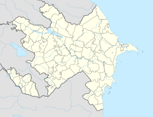
Quşçular, Lachin
Gushchular | |
|---|---|
| Azerbaijani: Quşçular | |
| Coordinates: 39°30′41″N 46°37′55″E / 39.51139°N 46.63194°E | |
| Country | |
| District | Lachin |
| Population (2015)[1] | |
• Total | 36 |
| Time zone | UTC+4 (AZT) |
Quşçular (also, Gushchular) is a former village in the Lachin District of Azerbaijan.
History
[edit]This village existed in the locality list of Ashaghi-Farajan Selsoviet (rural council) of Lachin District in 1963,[2] but did not exist in the same list of 1968.[3] Currently this locality also does not exist in the locality list of Lachin District.[4] It may mean that this village was abolished between 1963 and 1968.
This locality was located in the Armenian-occupied territories surrounding Nagorno-Karabakh, coming under the control of ethnic Armenian forces during the First Nagorno-Karabakh War in the early 1990s, subsequently becoming part of the breakaway Republic of Artsakh as part of its Kashatagh Province, where it was known as Aghavnatun (Armenian: Աղավնատուն).[5] The locality was returned to Azerbaijan as part of the 2020 Nagorno-Karabakh ceasefire agreement.[6]
Historical heritage sites
[edit]Historical heritage sites in and around the village include three 14th/15th-century khachkars, a 15th/16th-century khachkar, and the 15th/16th-century St. Stephen's Church (Armenian: Սուրբ Ստեփանոս եկեղեցի, romanized: Surb Stepanos Yekeghetsi) in the neighboring village of Harar.[1][7]
References
[edit]- ^ a b Hakob Ghahramanyan. "Directory of socio-economic characteristics of NKR administrative-territorial units (2015)".
- ^ Азербайджанская ССР. АДМИНИСТРАТИВНО-ТЕРРИТОРИАОТНОЕ ДЕЛЕНИЕ НА 1 ОКТЯБРЯ 1963 ГОДА (ИЗДАНИЕ ВТОРОЕ ed.). Баку: Азернешр. 1964. p. 80.
- ^ Melnikov, S. A.; Mirzəyeva, A. H. (1968). İsayev, A. M. (ed.). AZƏRBAYCAN SSR. İNZİBATİ-ƏRAZİ BÖLGÜSÜ. 1968--ci il İYULUN 10-dək OLAN VƏZİYYƏTƏ GÖRƏ TƏRTİB EDİLMİŞDİR (ÜÇÜNCÜ NƏŞRİ ed.). Bakı: Azərnəşr. p. 62.
- ^ Təsnifat, T.Y. (2020). İNZİBATİ ƏRAZİ BÖLGÜSÜ TƏSNİFATI, 2019 (PDF). Budaqovun rəhbərliyi ilə Y.X.Yusifov, V.H.Məmmədəlizadə, L.H.Salamzadə və F.E. Qocayev tərəfindən işlənib hazırlanmışdır. BAKI: AZƏRBAYCAN RESPUBLİKASININ DÖVLƏT STATİSTİKA KOMİTƏSİ. pp. 77–78.
- ^ National Statistic Service of the Republic of Artsakh. "The Results of the 2005 Census of the Nagorno-Karabakh Republic" (PDF) (in Armenian). Archived (PDF) from the original on 2011-03-02. Retrieved 2022-12-13.
- ^ "Ilham Aliyev addressed the nation » Official web-site of President of Azerbaijan Republic". president.az. Retrieved 2024-02-23.
- ^ "St. Stepanos Church of Harar". monumentwatch.org.


