Leighton Road Cutting
Appearance
| Site of Special Scientific Interest | |
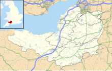
| Location | Somerset |
|---|---|
| Grid reference | ST702437 |
| Coordinates | 51°11′30″N 2°25′40″W / 51.19174°N 2.42781°W |
| Interest | Geological |
| Area | 0.6 hectares (0.0060 km2; 0.0023 sq mi) |
| Notification | 1984 |
| Natural England website | |
Leighton Road Cutting (grid reference ST702437) is a 0.6 hectare geological Site of Special Scientific Interest between East Cranmore and Cloford in Somerset, notified in 1984. It is a Geological Conservation Review site
Leighton Road Cutting provides exposure of a series of early Jurassic limestones, of Lower Lias age, which are the only known outcrops of these particular rocks to occur in a normal horizontally-bedded sequence in the Mendips. The discovery of the Leighton Road Cutting sections enabled geologists to understand how the fissure infills seen widely throughout the Mendips had been formed.
Sources
[edit]- English Nature citation sheet for the site (accessed 10 August 2006)
External links
[edit]- English Nature website (SSSI information)

