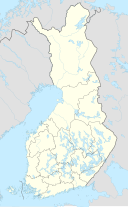
Lievestuoreenjärvi
Appearance
| Lievestuoreenjärvi | |
|---|---|
 | |
| Location | Laukaa |
| Coordinates | 62°19′N 026°09′E / 62.317°N 26.150°E |
| Type | Lake |
| Primary inflows | Hohonjoki |
| Primary outflows | Sahinjoki |
| Catchment area | Kymijoki |
| Basin countries | Finland |
| Surface area | 40.52 km2 (15.64 sq mi) |
| Average depth | 9.91 m (32.5 ft) |
| Max. depth | 70 m (230 ft) |
| Water volume | 0.4 km3 (320,000 acre⋅ft) |
| Shore length1 | 107.4 km (66.7 mi) |
| Surface elevation | 84.9 m (279 ft) |
| Frozen | December–April |
| Islands | Kirvessaari, Pukkisaari, Lamposaari, Kieräsaari |
| Settlements | Laukaa |
| References | [1] |
| 1 Shore length is not a well-defined measure. | |
Lievestuoreenjärvi is a medium-sized lake in the municipality of Laukaa, Finland.[1] On the southern shore of the lake lies Lievestuore village. On the eastern side of the lake there is Hyyppäänvuori hill, which forms a Natura 2000 protection area. The hill in valuable because of its scenic rocky views and offers attractive views of the lake.[2]
See also
[edit]References
[edit]- ^ a b Lievestuoreenjärvi in Järviwiki (in English)
- ^ Hyyppäänvuori protection area (in Finnish)

