Marche-les-Dames
Appearance
Marche-les-Dames
Måtche-les-Dames (Walloon) | |
|---|---|
 The rockface across the Meuse river from Marche-les-Dames where Albert I of Belgium drew his last breath | |
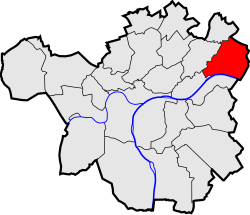
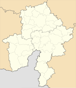
 Location of Marche-les-Dames in Namur | |
| Coordinates: 50°29′06″N 4°57′36″E / 50.48500°N 4.96000°E | |
| Country | |
| Community | |
| Region | |
| Province | |
| Arrondissement | Namur |
| Municipality | Namur |
| Area | |
• Total | 6.87 km2 (2.65 sq mi) |
| Population (2020-01-01) | |
• Total | 1,000 |
| • Density | 150/km2 (380/sq mi) |
| Postal codes | 5024 |
| Area codes | 081 |
Marche-les-Dames (French pronunciation: [maʁʃ le dam]; Walloon: Måtche-les-Dames) is a sub-municipality of the city of Namur located in the province of Namur, Wallonia, Belgium. It was a separate municipality until 1977. On 1 January 1977, it was merged into Namur.[1]
It is located downstream of the Sambre confluence, on the left bank of the Meuse river. Because of the high cliffs this place is popular with rock climbers.[citation needed]
History
[edit]
King Albert I died here in a 1934 mountaineering accident. The King fell from a rock face and his dead body was found later.[2] At this site a memorial was erected to honour the king.[citation needed]
- 2009: Sister Smile de Stijn Coninx
- 2012: La Marque Des Anges de Sylvain White
- 2015: Public Enemy (TV series) de Matthieu Frances et Gary Seghers
References
[edit]- ^ "LISTE ALPHABETIQUE DES COMMUNES - Fusions de 1963 à 1977" (PDF).
- ^ "DNA Tests Quash King Albert I Death Conspiracy Theory". New Historian. 24 July 2016.
- ^ "Marche-les-Dames", Wikipédia (in French), 10 March 2021, retrieved 24 July 2021
Wikimedia Commons has media related to Marche-les-Dames.


