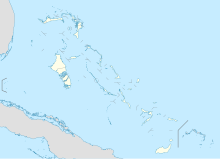
New Providence Airport
Appearance
This article includes a list of general references, but it lacks sufficient corresponding inline citations. (August 2013) |
New Providence Airport | |
|---|---|
| Summary | |
| Airport type | Private |
| Serves | Paradise Island |
| Location | Bahamas |
| Elevation AMSL | 4 ft / 1 m |
| Coordinates | 25°4′45″N 77°17′36″W / 25.07917°N 77.29333°W |
| Map | |
 | |
New Providence Airport (IATA: PID, ICAO: MYPI) was a private use airport located on Paradise Island, the Bahamas. It closed in 1999 and the land incorporated into the island resort.
See also
[edit]References
[edit]- ^ Airport record for New Providence Airport at Landings.com. Retrieved 2013-08-08
- ^ "location of New Providence Airport" (Map). Google Maps. Retrieved 2013-08-08.
External links
[edit]- Airport record for New Providence Airport at Landings.com

