Template:POTD/2016-07-08
Appearance
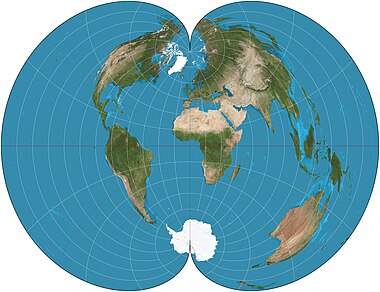
The American Polyconic projection is a map projection conceptualized as "rolling" a separate cone tangent to the Earth at each parallel of latitude, rather than a single cone as in a normal conic projection. Each parallel is a circular arc of true scale. The scale is also true on the central meridian of the projection. This projection was in common use by many map-making agencies of the United States from the time of its proposal by Ferdinand Rudolph Hassler in 1825 until the mid-20th century.Map: Strebe, using Geocart

