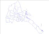
Teseney subregion: Difference between revisions
Appearance
Content deleted Content added
Adding geodata: {{coord missing|Eritrea}} |
mNo edit summary |
||
| (47 intermediate revisions by 16 users not shown) | |||
| Line 1: | Line 1: | ||
{{Infobox |
{{Infobox settlement |
||
|name = Teseney |
|name = Teseney |
||
|settlement_type = |
|settlement_type = [[Subregions of Eritrea|Subregion]] <!--For Town or Village (Leave blank for the default City)--> |
||
|official_name = |
|official_name = |
||
|other_name = |
|other_name = |
||
| Line 16: | Line 16: | ||
|image_shield = |
|image_shield = |
||
|shield_size = |
|shield_size = |
||
|image_blank_emblem |
|image_blank_emblem = |
||
|blank_emblem_size |
|blank_emblem_size = |
||
|image_map = |
|image_map = |
||
|mapsize = 200px |
|mapsize = 200px |
||
| Line 29: | Line 29: | ||
|subdivision_name = {{ERI}} |
|subdivision_name = {{ERI}} |
||
|subdivision_type1 = [[Regions of Eritrea|Region]] |
|subdivision_type1 = [[Regions of Eritrea|Region]] |
||
|subdivision_name1 = [[Gash-Barka]] |
|subdivision_name1 = [[Gash-Barka Region|Gash-Barka]] |
||
|subdivision_type2 = |
|subdivision_type2 = Capital |
||
|subdivision_name2 = |
|subdivision_name2 = [[Teseney]] |
||
|seat_type = |
|seat_type = |
||
|seat = |
|seat = |
||
| Line 42: | Line 42: | ||
|established_date = |
|established_date = |
||
|area_magnitude = |
|area_magnitude = |
||
|unit_pref = |
|unit_pref = Metric |
||
|area_footnotes = |
|area_footnotes = |
||
|area_total_km2 |
|area_total_km2 = |
||
|area_land_km2 |
|area_land_km2 = |
||
|area_water_km2 |
|area_water_km2 = |
||
|area_total_sq_mi |
|area_total_sq_mi = |
||
|area_land_sq_mi |
|area_land_sq_mi = |
||
|area_water_sq_mi |
|area_water_sq_mi = |
||
|area_water_percent = |
|area_water_percent = |
||
|area_urban_km2 |
|area_urban_km2 = |
||
|area_urban_sq_mi |
|area_urban_sq_mi = |
||
|area_metro_km2 |
|area_metro_km2 = |
||
|area_metro_sq_mi |
|area_metro_sq_mi = |
||
|population_as_of = |
|population_as_of = |
||
|population_footnotes = |
|population_footnotes = |
||
|population_note = |
|population_note = |
||
|population_total = |
|population_total = |
||
|population_density_km2 |
|population_density_km2 = |
||
|population_density_sq_mi = |
|population_density_sq_mi = |
||
|population_metro = |
|population_metro = |
||
| Line 72: | Line 72: | ||
|utc_offset_DST = |
|utc_offset_DST = |
||
|latd=|latm=|lats=|latNS= |
|latd=|latm=|lats=|latNS= |
||
|longd=|longm=|longs= |
|longd=|longm=|longs=|longEW= |
||
|elevation_footnotes = <!--for references: use <ref> tags--> |
|elevation_footnotes = <!--for references: use <ref> tags--> |
||
|elevation_m |
|elevation_m = |
||
|elevation_ft = |
|elevation_ft = |
||
|postal_code_type = <!-- enter ZIP code, Postcode, Post code, Postal code... --> |
|postal_code_type = <!-- enter ZIP code, Postcode, Post code, Postal code... --> |
||
| Line 83: | Line 83: | ||
}} |
}} |
||
'''Teseney |
'''Teseney subregion''' is a [[Subregions of Eritrea|subregion]] in the western [[Gash-Barka Region|Gash-Barka]] [[Regions of Eritrea|region]] (Zoba Gash-Barka) of [[Eritrea]]. Its capital lies at [[Barentu, Eritrea|barentu ]]. |
||
==References== |
|||
==Towns and villages== |
|||
| ⚫ | |||
== Source == |
|||
| ⚫ | |||
{{Districts of Eritrea}} |
{{Districts of Eritrea}} |
||
{{coord|15.1078|N|36.6561|E|source:wikidata|display=title}} |
|||
{{coord missing|Eritrea}} |
|||
[[Category: |
[[Category:Subregions of Eritrea]] |
||
{{eritrea-geo-stub}} |
{{eritrea-geo-stub}} |
||


